loader image

Application cases

Innovation at your service

For several years, we have been developing technology that enables us to adapt our unmanned aerial vehicles (UAVs) to different fields of application. As marine and environmental applications are constantly in demand, our BOREAL RPAS allows us to meet our customers’ requirements in a customized manner. We have now become a reference in our field and can provide our expertise, know-how, and technology for flight campaigns across various fields of application.

Maritime surveillance

Maritime surveillance enhances the safety and security of coastal territories. Some of the activities undertaken include detecting illegal boats and aiding rescue operations at sea. Additionally, maritime surveillance plays a vital role in preserving the environment, such as preventing illegal fishing, monitoring protected species, and surveilling marine pollution (such as oil spills).

Our unmanned aircraft system meets all the requirements of maritime surveillance. Equipped with an on-board gimbal camera, the BOREAL ISR UAV can provide 360-degree visuals during both day and night, allowing targets to be identified from a distance of 1.5 km. It can be operated from a pilot station located several dozen kilometres away.

Supervision of large agricultural areas

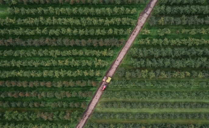
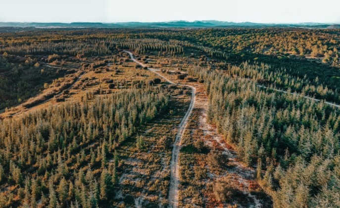
It is crucial for farmers to monitor their crops, detect the presence of pests, and analyze the soil composition. The use of UAVs offers an alternative solution to satellite imagery, with more accurate results due to their low-altitude flight.

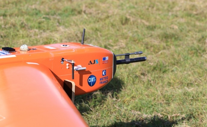
Our BOREAL NRM UAV is equipped with the latest generation of high-precision, high-resolution photogrammetric payloads, capable of collecting data from large and very large agricultural areas ranging from 2,000 to 50,000 hectares (4,942 to 123,553 acres).

Monitoring of land routes

Certain critical situations, such as detecting and surveilling suspicious activity or exceptional convoys, require the securing of communication routes and road traffic from the air. These use cases ensure a high level of safety and security for goods and people.

Equipped with an on-board gimbal camera, the BOREAL ISR UAV can provide 360-degree visuals during both day and night, allowing targets to be identified from a distance of 1.5 km. It can be operated from a pilot station located several dozen kilometres away.

Inspection of infrastructure and industrial sites

Linear infrastructure requires constant inspection and maintenance, but due to its large size, rigorous monitoring can become challenging. We offer support for this type of mission through our complete RPAS, which allows for real-time visualization of the entire infrastructure in a single flight with up to 8 hours of autonomy.

Crisis management support

In case of emergencies such as fire outbreaks, the BOREAL ISR‘s night vision camera is an invaluable asset for night interventions. The aircraft can be deployed several kilometers away from the risk area in less than 30 minutes, providing additional assistance to firefighters in controlling the progress of fires. BOREAL is also capable of supporting victim rescue and conducting surveillance of critical areas during natural or man-made disasters.

Land register

Thanks to its advanced photogrammetric payloads, our remotely piloted aircraft can map and measure parcel plans in a very precise and clear manner.

Scientific research

The BOREAL LAB UAV is popular for its ability to carry heavy and bulky payloads, making it ideal for research laboratories seeking to test and validate their increasingly innovative equipment and prototypes. The aircraft integrates several types of customised scientific payloads, which are a key element in conducting experiments.

Scientific meteorology

UAVs are necessary when the location is too remote for airport infrastructure, such as in deep sea or polar regions. They are also a strategic solution for risky aircraft operations, such as low altitude flights, crossing volcanic or industrial plumes, or convective zones. Thanks to its long range and great endurance, the BOREAL LAB UAV opens up new perspectives in collecting climatic and environmental measurements.