
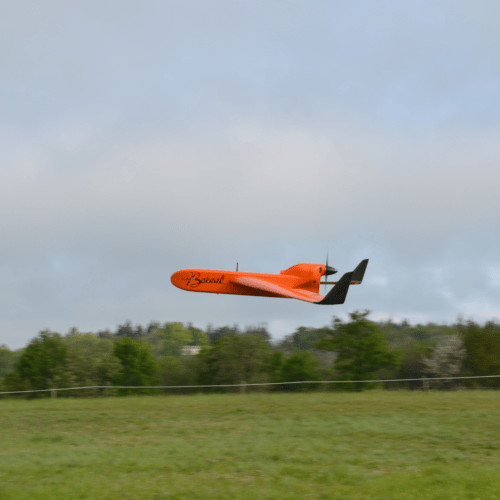
Equipped with a latest generation hyperspectral camera, the BOREAL drone flew to the ONERA site in Esperce on Tuesday August 27 to collect the data necessary for the progress of the TERRISCOPE project.
The Terriscope project is a shared research platform in airborne optical remote sensing for the study of the environment and the territories overflown from planes and drones.
In other words, the hyperspectral camera carried by the BOREAL drone makes it possible to visualize and characterize the environment overflown thanks to the capture of a very large number of spectral bands. It provides scientists with precise images of the state of the environment flown over by providing them with elements invisible to the naked eye, detected by minute color variations. This is useful for several areas such as agriculture or building surveillance for example. Other payloads are also used in this project, always with a view to visualization and study of the environment. The aim of this project is to develop the range of services based on airborne remote sensing, in particular for the drone sector.
The platform is co-financed by the European Union (European Regional Development Fund), the Occitanie region, ONERA, and four manufacturers investing in kind in the project: SOFRADIR, LEOSPHERE, M3 SYSTEMS and BOREAL.
More information on the TERRISCOPE project
French version
The BOREAL drone flight for the Terriscope project
Equipped with a hyperspectral camera latest generation, the drone BOREAL made a flight Tuesday, August 27 to collect data necessary for the advancement of the TERRISCOPE project.
The Terriscope project is a shared platform research project dedicated to study territories overflown by aircraft and drones.
The hyperspectral camera carried by the BOREAL UAV allows to visualize and characterize the environment overflown thanks to capturing a large number of spectral bands. It provides accurate images of the environment state which can be useful for agriculture application or infrastructure monitoring for example.
Other payloads are also used in this project, always in view of visualization and environmental study.
This project aims to develop the service offer based on airborne remote sensing.
The platform is co-financed by the European Union (European Regional Development Fund), the Occitanie region, ONERA, and four industrial investors investing in the project: SOFRADIR, LEOSPHERE, M3 SYSTEMS and BOREAL.