


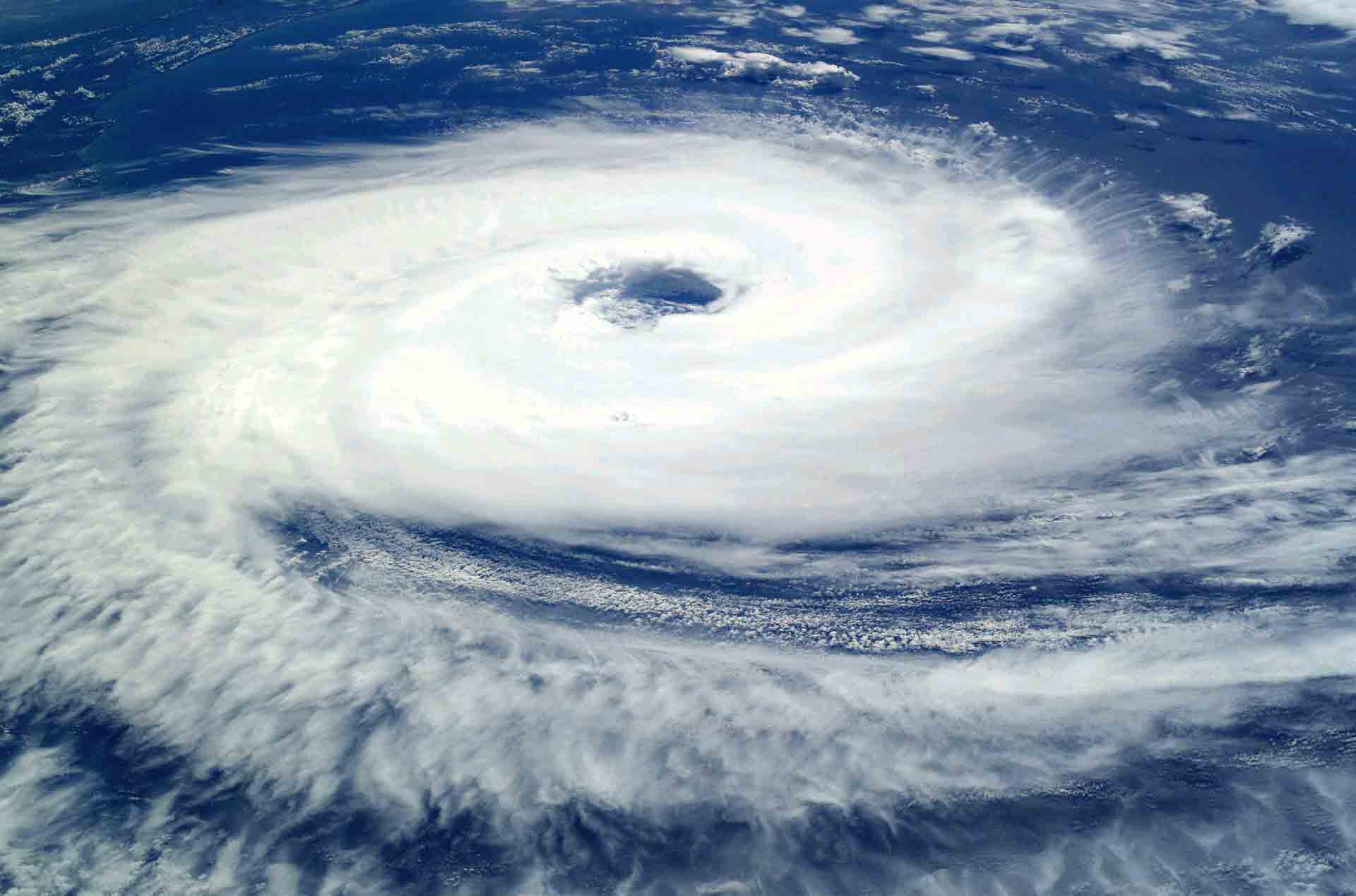
A measurement campaign to sample the atmosphere above the Indian Ocean in areas where cyclones form has just ended in Reunion. A look back at this mission, the objective of which is to improve hurricane forecasts.
A first flight campaign of the Boréal drone took place, from February 3 to 18, 2019, in Reunion, as part of the Renovrisk-Miriad project. It brought together teams from the CNRM/GMEI*, the company Boréal SAS, the Atmosphere and Cyclone Laboratory (LACy) and the University of La Réunion. Its objective was to sample the environment in which cyclones form, in particular the emissions of marine aerosols in strong winds, to evaluate the performance of the model and improve it. This campaign was thus able to test the logistics, the Boréal drone system and its instrumentation, but also quantify the fluxes of marine aerosols in bottom conditions. A second campaign is planned, it will be carried out in real situation in hurricane alert.
The CNRM/GMEI MNPCA** team was in charge of logistics and scientific instrumentation consisting of: turbulence probe with inertial measurement unit, particle counter and granulometry, altimetric radar (wave height), sea surface IR temperature, solar radiation (pyranometer), pressure/temperature/humidity and camera. All instrument data was viewable in real time from the ground station.
The avionics consisted for the first time of a transponder, a dual communication system (radio frequency and satellite) and real-time feedback from the on-board camera to avoid the overflight of boats.
It was necessary to deal with complex aerological conditions on the site of operations of the Cambaie ULM base (breeze effect, strong shear to the lee of the island, convergence zone, etc.) and, at times, meteorological conditions choppy (gusts at 17 m/s, squalls, waterspouts, etc.). Meteorological assistance was provided using the Synopsys tool, the support of Jérôme Viviand (based in Toulouse) and regular telephone conversations with the DIROI’s forecast unit.
6 flights were carried out during this first period, which represents a total of 22 hours of operation and 2,000 km covered. An important first set of data was collected under different weather conditions and therefore very promising. The flight plans have been adapted to weather situations with long or short “Legs”, at different levels (700 m/300 m/100 m), wide diameter racetracks and spiral type vertical profiles.
The raw material is now available: a long and important work of processing, analysis and then valorization begins, which should lead to a significant gain in the cyclone forecasting models (by better parameterization for example of marine aerosol emissions) and international visibility with publications in scientific journals.
https://umr-cnrm.fr/spip.php?article1088
http://www.atmosphere.aero/blog/renovrisk-drone-flew-in-indian-ocean-with-atmospheres-satcom/
https://www.linkedin.com/feed/update/urn:li:activity:6504414167271768064

